Trail Overview
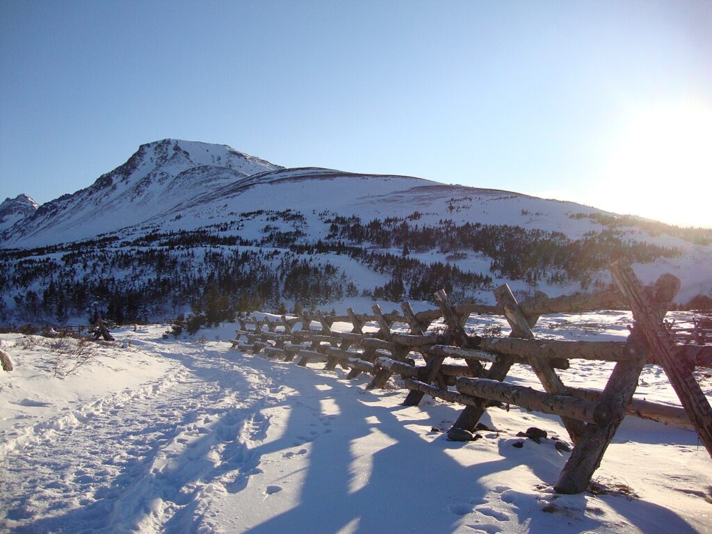
The Flattop Mountain Trail is one of Alaska’s most beloved and accessible hiking trails, offering breathtaking panoramic views of the surrounding mountains, glaciers, and Cook Inlet. Located in Chugach National Forest, this trail is a must-visit for outdoor enthusiasts and nature lovers. What makes this trail special is its unique combination of scenic beauty, moderate difficulty, and proximity to Anchorage, making it an ideal day-hike destination for locals and visitors alike. Hikers love the Flattop Mountain Trail for its well-maintained path, stunning vistas, and abundant wildlife viewing opportunities.
Trail Stats at a Glance
The following list provides a quick summary of the trail’s key statistics:
- Distance: 3.4 miles round-trip
- Elevation Gain: 1,350 feet
- Difficulty: Moderate
- Estimated Time: 3-5 hours
- Trail Type: Out-and-back
- Dog-Friendly?: Yes, but must be on a leash
- Kid-Friendly?: Yes, but recommended for children aged 8 and above due to steep terrain
Getting There
To access the Flattop Mountain Trail, follow these directions:
From Anchorage, take the Seward Highway (AK-1) south for approximately 15 miles. Turn left onto Glen Alps Road and continue for 2 miles. The Glen Alps Trailhead parking lot will be on your right, with GPS coordinates: 60.9922° N, 149.7333° W. The parking lot can accommodate up to 50 vehicles and has restrooms, potable water, and a information kiosk. There is a $5 day-use fee, which can be paid at the self-service pay station.
The trailhead facilities include a large map display, bear-resistant trash cans, and a ranger station (open during summer months). Be sure to check the trail conditions and weather forecast before embarking on your hike.
Detailed Trail Description
The Flattop Mountain Trail begins at the Glen Alps Trailhead, where you’ll find a well-marked sign and a large map display. The trail starts on a gentle, paved path, winding through a dense spruce forest. As you hike, the trees gradually give way to shrubs and wildflowers, offering glimpses of the surrounding mountains.
At approximately 0.5 miles, the trail intersects with the Powerline Trail. Continue straight, following the signs for Flattop Mountain. The trail begins to climb more steeply, with a series of switchbacks that lead you up the mountain’s southern slope. Keep an eye out for wildflowers, including forget-me-nots, gentians, and fireweed, which bloom in mid-to-late summer.
At 1.5 miles, the trail reaches a small saddle, where you’ll find a sign indicating the summit is still 1 mile away. The terrain becomes rockier, with loose scree and boulders. Be cautious of your footing, as the trail can be slippery when wet. As you ascend, the views become increasingly spectacular, with the Chugach Mountains, Cook Inlet, and surrounding glaciers coming into view.
The final push to the summit involves a short, steep climb up a rocky slope. The top of Flattop Mountain (3,510 feet) offers breathtaking 360-degree views, including the Kenai Mountains, Turnagain Arm, and the Anchorage skyline. Take a moment to soak in the scenery, snap photos, and enjoy a well-deserved snack or lunch.
On your descent, be mindful of your footing and take your time, as the rocky terrain can be hazardous. Consider bringing trekking poles to aid with balance and stability. Once you’ve returned to the trailhead, take a moment to explore the surrounding area, which includes several other trails, scenic overlooks, and picnic areas.
Best Time to Hike
The Flattop Mountain Trail is accessible from mid-May to October, depending on snow conditions. Here’s a month-by-month breakdown:
- May: Snow can still be present on the upper sections of the trail, making it challenging to reach the summit. Wildflowers begin to bloom in the lower elevations.
- June: The trail is usually clear of snow, and wildflowers are in full bloom. This is an ideal time for hiking, with mild temperatures and long days.
- July: This is peak hiking season, with warm temperatures and dry conditions. Be prepared for crowds and potential thunderstorms.
- August: The weather can be unpredictable, with occasional rain showers and cooler temperatures. The wildflower season is still in full swing.
- September: The fall colors are stunning, with the surrounding mountains and valleys ablaze with yellow, orange, and red hues. The weather can be cooler, with potential snowfall.
- October: The trail may be snow-covered, making it more challenging to hike. However, the scenery can be breathtaking, with the surrounding mountains and glaciers taking on a serene, winter-like quality.
What to Bring
When hiking the Flattop Mountain Trail, it’s essential to be prepared with the right gear and knowledge. Here are the Ten Essentials adapted for Alaska:
- Navigation: Map, compass, GPS device or app
- Hydration: Water, water filter or treatment, hydration bladder
- Nutrition: Snacks, energy bars, lunch, bear-resistant container
- Shelter: Lightweight emergency shelter, space blanket
- Extra Clothing: Layers, rain gear, warm hat, gloves
- First Aid: First aid kit, blister care, pain relievers
- Headlamp/Flashlight: Extra batteries, headlamp or flashlight
- Repair Kit: Duct tape, multi-tool, repair patches
- Fire Starter: Matches, lighter, fire starter
- Personal Safety: Bear spray, whistle, personal locator beacon (PLB) or satellite phone
Additionally, consider bringing:
- Trekking poles: For added stability and balance on rocky terrain
- Bear-resistant container: For storing food and other scented items
- Layers: For adjusting to changing weather conditions
- Water treatment: For safe drinking water
Wildlife & Safety
The Flattop Mountain Trail is home to a variety of wildlife, including:
- Bears: Black bears and grizzly bears are present in the area. Make noise while hiking, carry bear spray, and store food and scented items in airtight containers.
- Moose: Moose can be encountered on the trail, particularly in the early morning and evening hours. Be cautious and keep a safe distance.
- Weather hazards: Be prepared for changing weather conditions, including rain, snow, and high winds. Bring layers, a waterproof jacket, and a warm hat.
- River crossing safety: There are no major river crossings on the Flattop Mountain Trail. However, be cautious when crossing small streams and creeks, as the water can be icy and fast-moving.
- Avalanche zones: The Flattop Mountain Trail does not have any designated avalanche zones. However, be aware of the potential for avalanches in the surrounding mountains, particularly during winter months.
Photography Tips
The Flattop Mountain Trail offers numerous photography opportunities, with breathtaking views, wildflowers, and wildlife. Here are some tips for capturing stunning images:
- Best viewpoints: The summit of Flattop Mountain, the saddle at 1.5 miles, and the scenic overlooks along the trail offer spectacular views of the surrounding mountains and Cook Inlet.
- Golden hour: The golden hour, just before sunset, offers warm, soft light that’s ideal for capturing stunning images of the landscape and wildlife.
- What lens to bring: A wide-angle lens (10-22mm) is ideal for capturing the expansive views, while a telephoto lens (70-200mm) is perfect for wildlife and portrait photography.
- Iconic shots: Look for opportunities to capture iconic shots, such as the summit sign, wildflowers in bloom, and wildlife in their natural habitat.
History & Background
The Flattop Mountain Trail has a rich history, dating back to the early 20th century. The trail was originally constructed by miners and prospectors, who used it to access the surrounding mountains and valleys in search of gold and other minerals. The trail was later improved and maintained by the U.S. Forest Service, which designated it as a recreational trail in the 1970s.
The name “Flattop” refers to the mountain’s unique shape, which features a flat, broad summit. The mountain is also known for its geological significance, with a unique combination of rocks and minerals that tell the story of Alaska’s complex geological history.
Indigenous peoples, including the Dena’ina and Athabascan tribes, have a long history in the area, with evidence of their presence dating back thousands of years. The trail passes through traditional hunting and gathering grounds, and hikers may encounter archaeological sites and cultural artifacts along the way.
Nearby Trails & Campgrounds
The Flattop Mountain Trail is part of a larger network of trails and campgrounds in Chugach National Forest. Some nearby trails and campgrounds include:
- Powerline Trail: A 10-mile trail that follows the powerline corridor, offering stunning views of the surrounding mountains and Cook Inlet.
- Glen Alps Trail: A 2-mile trail that connects the Glen Alps Trailhead to the Flattop Mountain Trail, offering scenic views and access to the surrounding mountains.
- Williwaw Campground: A scenic campground located near the Glen Alps Trailhead, offering 12 campsites, restrooms, and potable water.
- Black Bear Campground: A remote campground located near the Powerline Trail, offering 6 campsites, a vault toilet, and scenic views of the surrounding mountains.
For multi-day adventures, consider combining the Flattop Mountain Trail with other nearby trails, such as the Powerline Trail or the Glen Alps Trail. Be sure to plan ahead, check the weather forecast, and bring the necessary gear and supplies for a safe and enjoyable trip.